Sandra has just returned from her native Azores where she was researching the upcoming Pocket Azores guidebook - out October 2024.
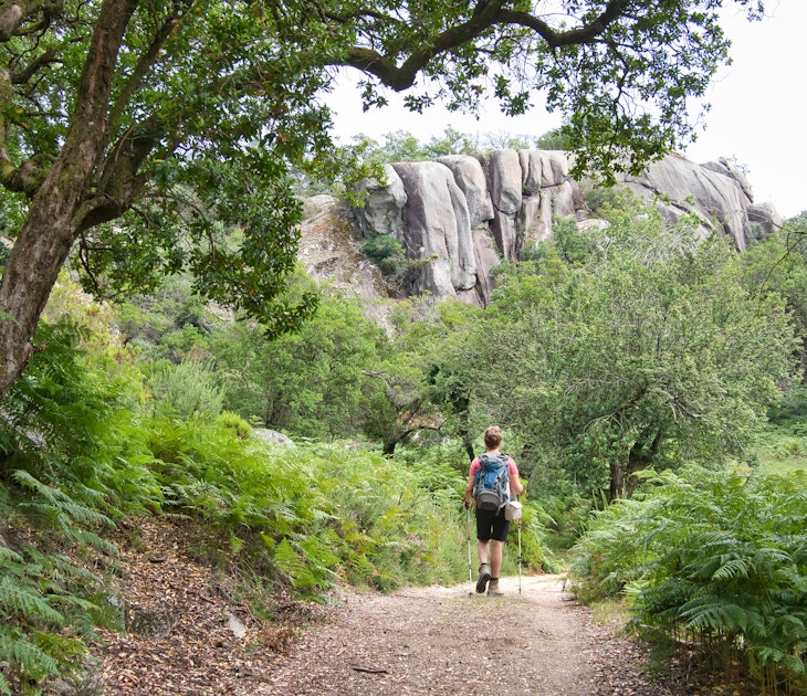
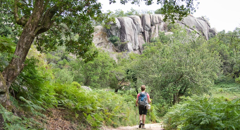
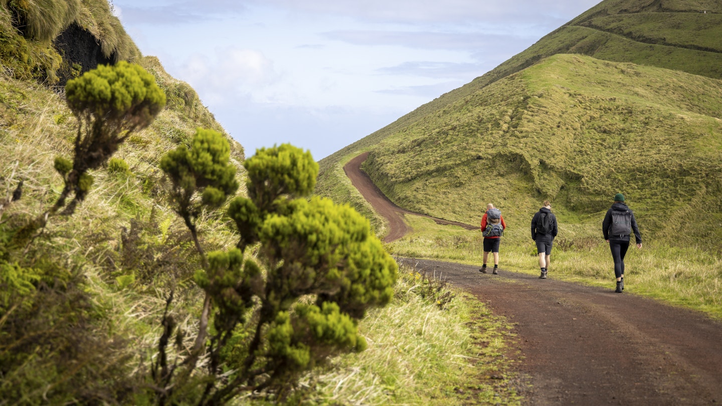
The Azores are heaven for nature lovers and outdoors enthusiasts, with dozens of hiking trails to choose from. The well-marked official paths cut through hills, small woods and pastures, twisting up and down the rugged basalt coast. The experience of hiking in the Azores embodies the philosophy that it’s the journey that matters, not the destination, as travelers uncover the islands' protected nature reserves, nature parks and quasi-untouched landscapes in their wildest state.
Pack your hiking boots and trekking poles because you’ll need them, even on the trails classified as easy. The uneven terrain deems most trails as moderate or hard. While most of our suggestions for hikes follow official trails, we've included a few that are not classified as such but worthy of mention for the views they offer or because they're more accessible for travelers not as accustomed to hiking.
Here are the best hikes in the Azores.
1. Caldeirão
Best walk to grasp the smallest island
6km (3.7mi) one-way, 2 hours, easy
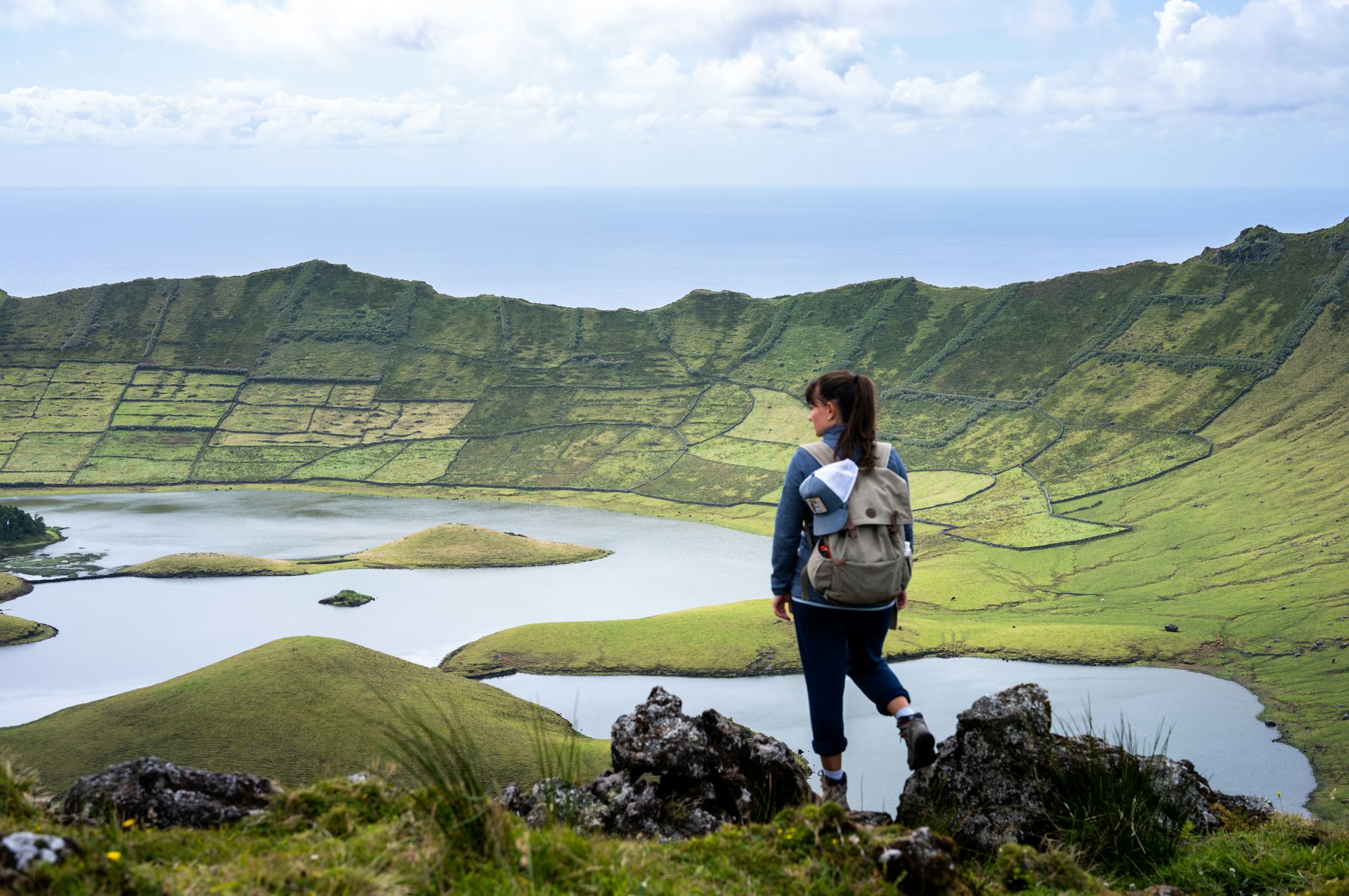
Corvo, the smallest island in the Azores, is also the most isolated, boasting only one town with a little under 400 people clustered on the lowest region near the ocean. The rest is pastures and the water-filled crater of the inactive volcano that originated the island — Caldeirão.
Estrada do Caldeirão starts at the only roundabout in Corvo – across from the post office – and snakes up the island through farmland and moss-covered hills, its inclination gently increasing the closer you get to your destination. With any luck, around you there won’t be more than the occasional farmer driving by, the peering eyes of grazing cattle and the feeling you have the island all to yourself.
If you’re staying on the island, walk up to Caldeirão as early in the morning as possible before the tour boats from Flores arrive – during peak season, there can be more than a dozen people arriving in Corvo daily and they’ll all flock to the lagoon. Brave the fog and the wind for a hopefully clear view of the lagoon, and walk toward town before lunch. For travelers on the island for just a few hours, hitch a ride or pay someone to drive you up (approx. €10 per person), and then walk back.
2. Monte da Guia
Best exercise walk
3km (1.8mi) roundtrip, 1 hour, easy
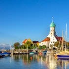
With good weather, plenty of Horta locals park near Fábrica da Baleia de Porto Pim and walk or cycle uphill to Monte da Guia and back on a mostly flat path. Although it never truly gets busy (most tourists drive up for sightseeing purposes or hike the Entre Montes PRC08 FAI trail instead), be prepared to share the road with folks on their daily exercising outings.
Near Forte de Nossa Senhora da Guia there is a must-see viewpoint from where you have one of the most spectacular views of nearby Pico. And, of course, take some time to appreciate the view over Porto Pim bay and Horta from the church at the top of the hill.
3. Mata do Canário
Best for iconic landscapes
11.8km (7.3km) one-way, 3 hours, moderate
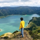
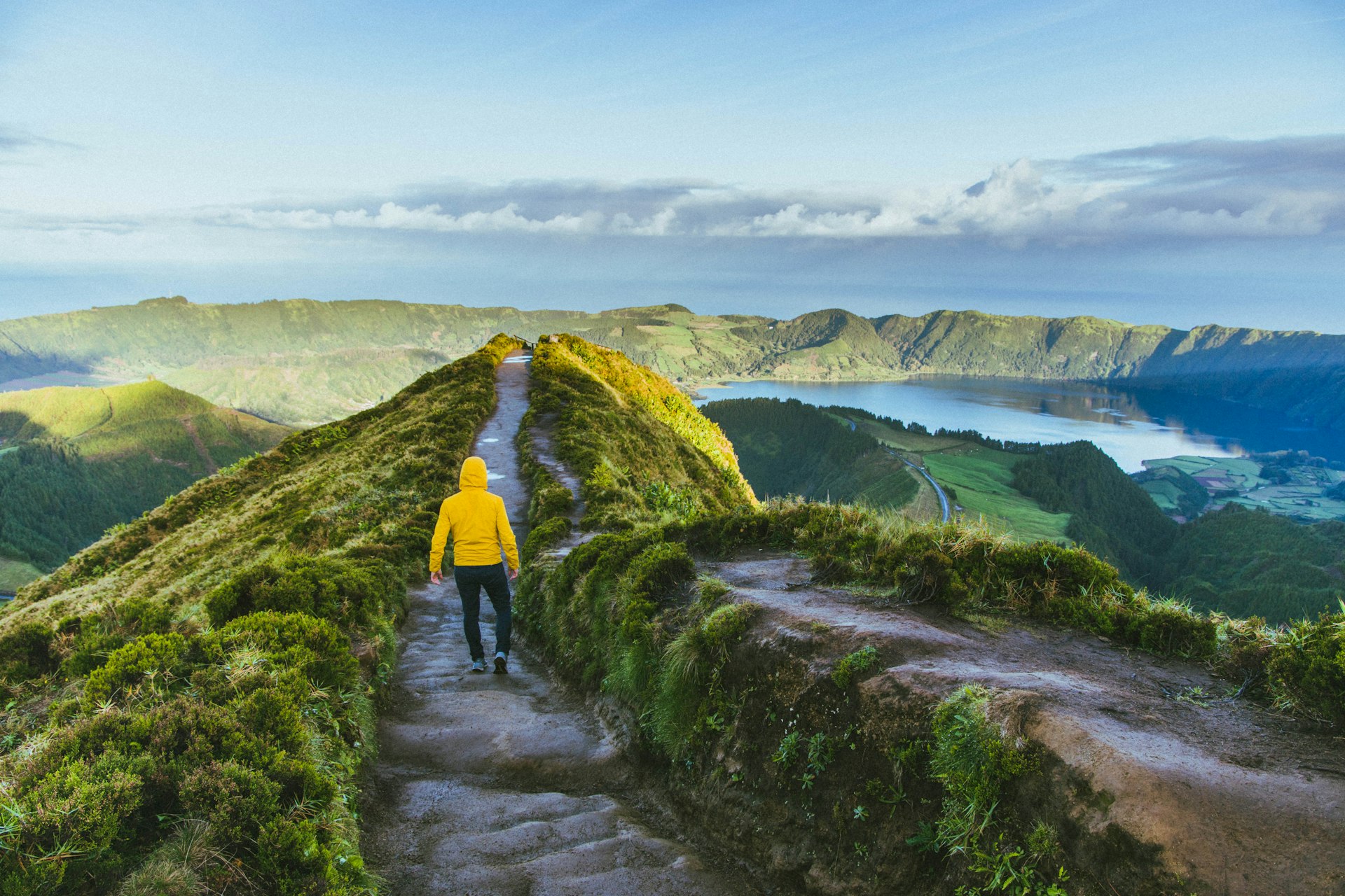
As one of the most visited islands in the Azores, São Miguel’s iconic lagoons and viewpoints often pop up on social media as the quintessential Azorean landscapes. At the Mata do Canário trail, you can find one of those envy-inducing photo ops as you walk downhill on rough (sometimes steep) and slippery terrain, with eyes locked on the famous blue and green lakes of Sete Cidades.
You can park your rental car near the starting point, but it’s simpler to drive to Sete Cidades and hire a taxi (approx. €15) to drop you off there. The trail ends near Igreja de São Nicolau in the center of the town.
4. PR01 SJO
Most famous trail
9.5km (6mi) one-way, 3 hours, moderate
It is the most famous trail in the archipelago and it comes with a true reward midway: São Jorge's most isolated and hard-to-reach village, Fajã da Caldeira de Santo Cristo. If you're on the island in the summer (most accommodations and restaurants are closed off-season) and have time to spare, split this hike in two and spend the night at Caldeira before heading to the final stop at Fajã dos Cubres.
It's a good trail to do as a family if you’re traveling with older kids who can handle the walk, with plenty of resting stops along the way.
This hiking route starts at Serra do Topo via a narrow, slightly uphill dirt path lined with thick vegetation. The trail begins to go gently downhill after about 50m, zigzagging around hills and cliffs – a trekking pole and hiking boots with good grip come in handy, even more so if it has recently rained.
5. Fajã de Lopo Vaz
Best hike for natural beauty
3.4km (2.1mi) roundtrip, 2 hours, moderate
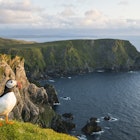
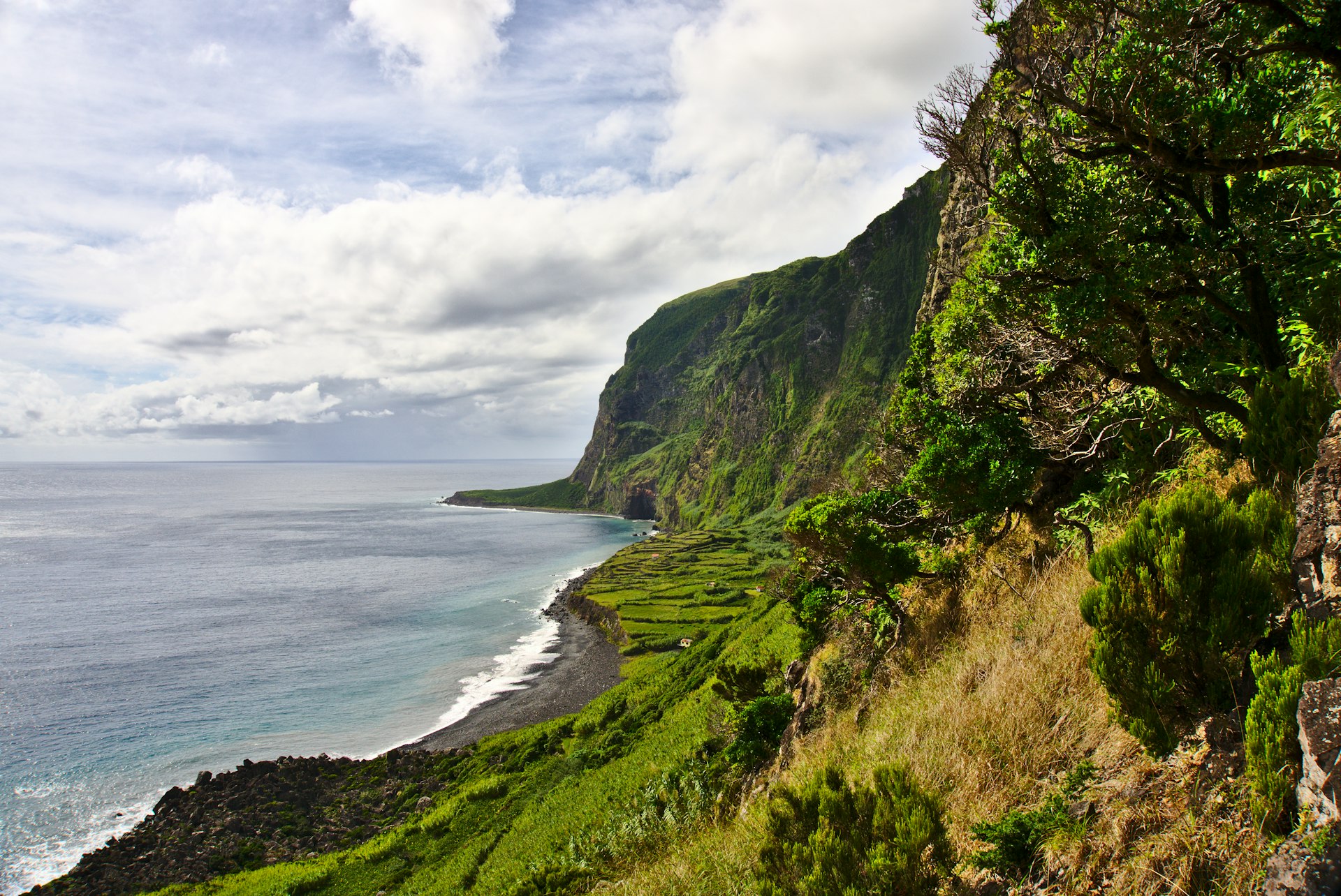
Ask an Azorean which island in the archipelago is the most beautiful, and they'll tell you it's the one where they live (of course), rivaled only by Flores. I second that, not only because Flores is my home island but also because it's hard to beat its untouched natural beauty.
Fajã de Lopo Vaz is one of Flores' most famous hiking trails. A very steep rock and dirt path that plunges down the island's south coast, it's a challenging route that offers gorgeous views, plants and flowers you won’t see elsewhere in Flores and a pebble beach where you can recharge before you go back up the same way.
Always mind your step and potential falling rocks, and be sure to download the trail map beforehand, as you won't have mobile service along the way.
6. Vinhas da Criação Velha
Best heritage walk
6.9km (4.3mi) one-way, 2 hours, easy
The landscape of the Pico Island Vineyard Culture is a UNESCO World Heritage Site, and this walk takes you to the heart of it. Set out on the trail from its official starting point in Porto do Calhau or do a shorter roundtrip version and begin at Porto da Areia Larga, in Madalena — from here to the windmill, it's about 2km (1.2mi) one way.
Regardless of where you choose to start from, most of the path follows an oceanside road with a view to neighboring Faial and the ever-present Mount Pico inland. Mind the traffic – at the time of writing, the road had been rebuilt after a major storm and parts of it didn’t have sidewalks yet. About halfway, as you get closer to the bright red Moinho do Frade, a gravel path will take you through the unique currais, an intricate pattern of low basalt walls protecting the vines from the ocean.
After the hike, if you want to complete the vineyards experience, stop by Adega do Vulcão for a wine tasting.
7. Chá Gorreana
Best walk for tea lovers
3.4 km (2.1mi) circular path, 1 1/2 hours, easy
One of the two tea farms in São Miguel (and the oldest in Europe) has its own official hiking trail. The PRC28 SMI trail starts across the street from Fábrica de Chá Gorreana, travels through small woods and pastures, and finally takes travelers to the famous tea fields.
After walking around the tea farm and stopping to admire the ocean views (weather permitting), follow the path back to the factory, where hikers are invited to sample a complimentary cup of the locally grown brew.
Tips for hiking in the Azores
- If you’re hiking alone, let your accommodation or someone you trust know which trail you’re taking, what time you’re starting the hike and when you expect to return. Alternatively, hire a taxi to drop you off and pick you up.
- If you feel uncomfortable walking the trails alone, plenty of local companies offer guided hiking tours.
- The weather in the Azores can change fast, especially closer to the coast or higher elevations. Travel light but be equipped for sudden changes.
- Trails are marked with yellow and red stripes signs – or white stripes if it’s a Grande Rota – every 500m (0.3mi), but outside the peak season and during storm season some paths may appear to be neglected. Download the official trail map to check if you’re on track along the way.
- Some trails cut across pastures. Make sure to always close the gates behind you and try not to disturb the cattle – keep your eyes peeled for cow droppings.
Keep planning your trip to the Azores:
Here's All you need to know for your first trip to the Azores
No car? No problem! Here's How to get the most out of the Azores without renting a car
So many islands and so little time! Plan ahead with An island-hopper's guide to the Azores